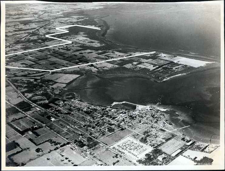
Aerial view
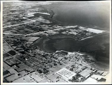
Aerial view
MEDIAImage
COLLECTIONHastings-Western Port Historical Society
REG NO.P349
HISTORYThis aerial view shows Hastings and the Western Port designated area for a steel mill. It is one of a series of aerial views of Hastings.
DESCRIPTIONThis image shows an aerial photograph of a town, farming lands and a shoreline. A large area of the land has been marked out in white lines. Two jetties can be seen at the lower right-hand side and many boats can be seen in the water. The number 15412 is written on the back in black pencil.
SUBJECTSAerial photographs, Bays, Cities and towns, Foreshores, Plans
KEYWORDS