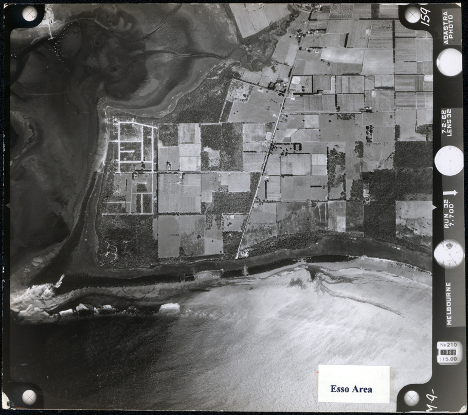
Aerial photo, c. 1960
Aerial photo, c. 1960
DATE1960
MEDIAImage
COLLECTIONHastings-Western Port Historical Society
REG NO.P389
HISTORYThis is one of a number of photos of the Western Port and Hastings taken prior to the ESSO building.
DESCRIPTIONThis image shows an aerial view of land jutting out to a point, with water on two sides. The land is broken up into many small paddocks and some houses can be seen dotted around. A bay on the far left-hand side of the image shows a jetty and boats, which look like little white specks, dotted on the water. A piece of white paper with “Esso Area” typed in black, is glued to the bottom of the image. Photographic information in white print, is down the right-hand side of the image.
SUBJECTSAerial photographs, Bays, Foreshores, Oil industry
KEYWORDS