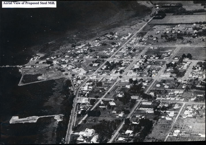
Aerial photo, c. 1960
Aerial photo, c. 1960
DATE1960
MEDIAImage
COLLECTIONHastings-Western Port Historical Society
REG NO.P390
HISTORYThis is one of a number of photos of the Western Port and Hastings taken prior to the Esso/BHP build.
DESCRIPTIONThis image shows an aerial photograph of a town with the foreshore and jetties on the left-hand side. Many houses, streets and trees can be seen. Some rural paddocks can be seen at the top and on the far right-hand side of the image. A piece of white paper with the words “Aerial View of Proposed Steel Mill.” typed in black, is glued to the top left-hand corner of the image.
SUBJECTSAerial photographs, Bays, Foreshores, Oil industry
KEYWORDS