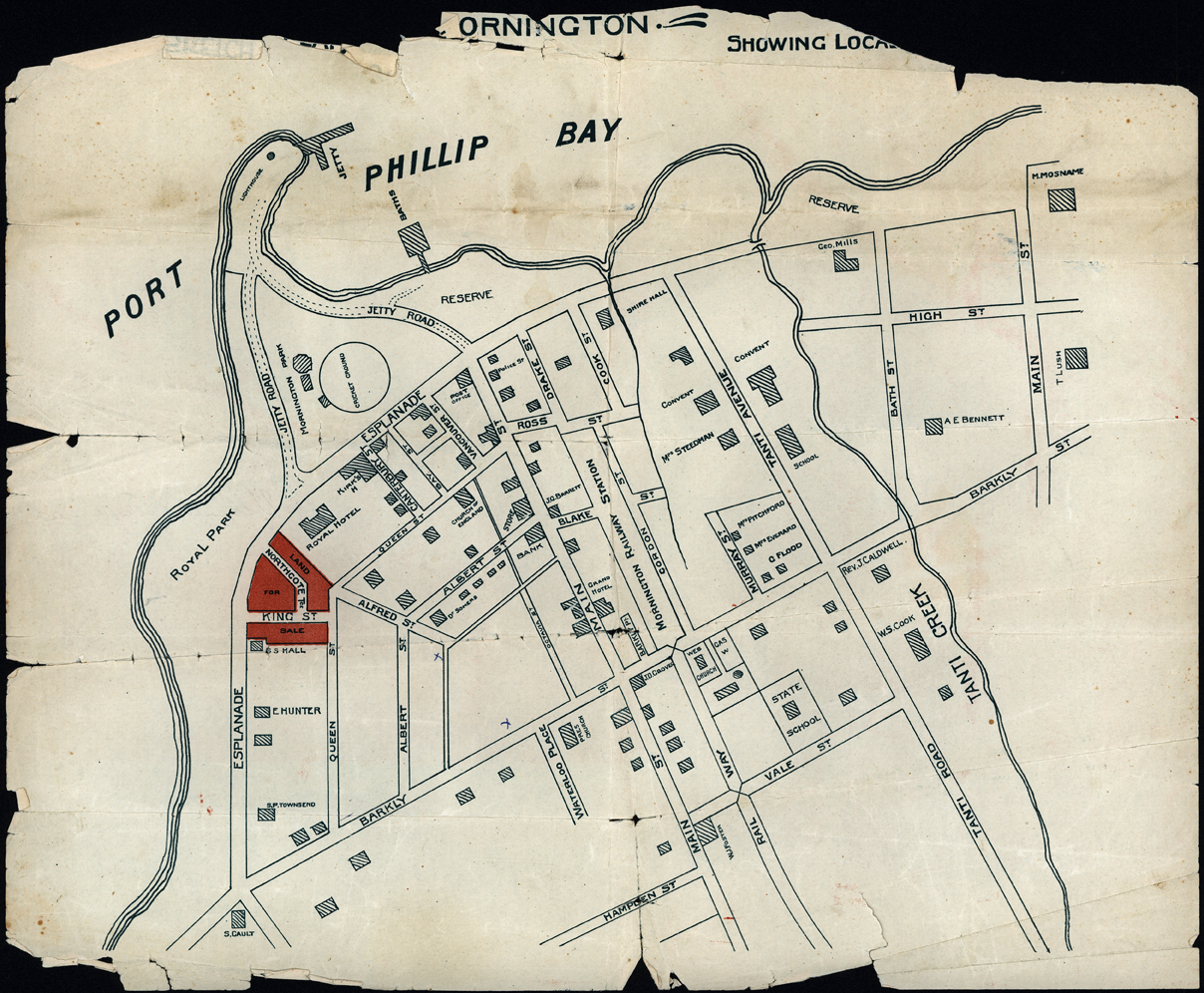
Early map of Mornington
OBJECT TITLE / NAME
Early map of Mornington
DATE1920s
MEDIAImage
COLLECTIONMornington and District Historical Society
REG NO.1416
DESCRIPTIONThis is a photograph of an early map of Mornington, It shows the Railway Station, and various properties along the Esplanade have the name of the owner:-E. Hunter, Townsend, and Hall. It is a very simple map. There is a cricket ground shown in the centre of Mornington Park. Royal Park is shown, in front of the Royal Hotel. The Jetty and Mornington Baths are shown.
SUBJECTS KEYWORDS