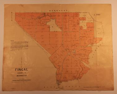
Parish Map of Fingal, County of Mornington
OBJECT TITLE / NAME
Parish Map of Fingal, County of Mornington
MEDIAArchive
COLLECTIONRye Historical Society
REG NO.Ar 87
HISTORYFreehold land from 1902
DESCRIPTIONMap showing (freehold) allotments coloured brown. Bounded on north by Wannaneue, West by Nepean, East by Flinders, South by Bass Strait.
SUBJECTS KEYWORDS